
RATANAK KIRI


Bordering Vietnam’s central Highlands and Laos are the remote provinces of Ratanakiri and Mondulkiri, both with thickly forested hilly terrain, hilltribe people, and abundant wildlife. Commercial enterprises in the region include logging gem mining and rubber plantations. A fertile basalt plateau with red dusty soil lies between the Sesan and Srepok rivers. The provincial capital of Sen Monorom is the best reached from Vietnam ; Ratanakiri is accessible by air from Phnom Penh. Over 80% of Ratanakiri’s population of 72,000 is classified as hilltribe, mainly Jarai, Krunh, Brou, and Tampuan. The 12 ethnic minority group are collectively called Khmer Loeu (highlanders), a name coined by Sihanouk in the 1940s. Some of the groups are found across the border of Vietnam’s Central highlands or in Southern Laos. Many also still wear traditional costume - Krung women in sarongs and bare-breasted, Brou women with tattooed faces and ivory tusk earrings in their elongated earlobes.
Less than 60,000 hilltribes people now remain and their numbers are further threatened by a high mortality rate from malaria, diarrhea and childbirth complications. Their lives and livelihoods are now also threatened by the encroachment of logging into their territory. So, although it would appear that these hilltribe communities have little contact with the outside world, it is likely that they wished the outside world was a lot further away.
The recent history of Ratanakiri is not a happy one. During the Vietnam War the province of Ratanakiri was devastated by American carpet booming because it formed part of the Ho Chi Minh Trail, which continued to run relatively undisturbed by the wanton destruction. However, the bombing not only killed and injured many tribes-people, it also drove away the animals they hunted and destroyed their farmlands. The Khmer Rouge used Ratanakiri as their main base of operations in the early 1970s; when they came to power in 1975, the Khmer Rouge wiped out at least half the tribal population. Most highlanders in Ratanakiri are animist and practice slash-burn agriculture. They farm rice and grow vegetable, and raise water buffalo and cows. They also hunt, using crossbows with poison-tipped bamboo arrows. Sacrifice to the numerous animal spirits of the forest is common, and regularly performed for any special events such as marriage, the construction of a new thatch-roofed hut, or a move to a new village location. At these events a feast is held, a pig sacrificed and large quantities of rice wine consumed. At these gatherings the spirits believed to take a possession of certain individuals, who in a trance lose their own personality and take on that of the spirit, acting out a particular animist trait. Pries tesses regarded as the spiritual healers contact ancestral spirits and relay dreams.
Highland women enjoy as much freedom as men. They are free to divorce a husband who is cruel, and decisions on childbirth are the exclusive domain of women. If an unmarriageable women finds herself pregnant, she is not disgraced the man responsible, if not willing to marry, must reimburse the woman’s family. The going rate is four buffaloes, some pigs, a few chickens and rice wine.
Although some hilltribers don Khmer dress, others retain traditional wear. Krung tribeswomen wear sarongs, go bare breasted, and smoke-stemmed pipes. Brou tribeswomen have large pierced earlobes and wearing earrings sculpted from chunky ivory tusks. Their faces are tattooed and they wear bead necklaces and brass anklets.
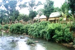
Ban Lung, population 10,000, is the principal town in Ratanakiri province, and lies 155 km east of Stung Treng. There may be direct flights into Bang Lung. The hotel in Bang Lung charges $5 a room; the town has a post office and bank. You can get to Bang Lung in five or seven hours, but the road may be washed out in the May - November monsoon season. In parts of Ratanakiri, the only vehicles that move during the rainy season are oxcarts and elephants.
TOURIST ATTRACTIONS
Yeak Loam Lake
Yeak Loam Lake is situated 5 km. south - east of Banlung. The Yeak Loam lake (volcanic crater) is the most beautiful lake of Ratanakiri formed by a volcanic eruption almost 4,000 years ago with 50 m. deep, 800 m. diameter and a walking path around the lake of 2,500 m. Two hundred meters of the track is a quaint wooden building housing tribal handicraft, the Crafts Museum.
Eisey Patamak Mountain
At the top of Phnom Svay is the statue of a reclining Buddha, situated 2.5 km. Awesome and peaceful, it has lain undisturbed throughout the years. Cast your eye outwards to glimpse Laos in the north and Vietnam in the east, and enjoy the spellbinding serenity of the surrounding countryside.
Kachang Waterfall
Kachang Waterfall is situated 6km. north - west of Banlung. This Waterfall is located in the Kontung stream and flows into the Sre Pok River. The height of it is 12 m. and the water flows and falls throughout the year. A beautiful or magnificent landscape and huge amounts of fresh mist surround the waterfall. The visitors can take a bath and sit to look at the waterfall and other natural scenic beauties. or the visitors can also go around to view other natural sights on foot or take an elephants ride.
Katieng Waterfall
Katieng Waterfall is situated 7 km. north - west of Banlung. It is also located in the Koutung Stream, below the Kachang Waterfall, 3 km. The height of it is 10m. and the water flows and falls throughout the year. The visitors can see a beautiful natural landscape and take a break to take pictures of the birds and then continue to the waterfall.
Ou'Sean Lair Waterfall
Ou'Sean Lair Waterfall is situated 26 km, South of Banlung. This Waterfall has 4 floors and the height of each floor is 4 m. The water flows throughout the year. Around the Waterfall are beautiful natural landscapes and the visitors can go take a bath if they wish.
Ou'Sensranoh Waterfall
Ou'Sensranoh Waterfall is situated 9 km. south of Banlung. The height of it is 18m. and the water flows and falls all the time. The visitors can go there rest and enjoy the fresh air, or to se the forest and listen to the birds ' cries.
Cha Ung Waterfall
Cha Ung Waterfall is situated 8 km. west of Banlung and it flows throughout the year. The source of water creating this Waterfall flowed from Eisey Patamak Mountain ( Svay Mountain ) . Below this Waterfall is a big hole, visitors can stand or sit to watch the waterfall from behind, and inhale he cool fresh air stemming from it .
Veal Rum Plang ( stone field)
Veal rum Plan (stone field ) is situated 14 km. North of Banlung. Stones cover the surface of this place and a dense around it. The visitors can go there and discover its beautiful attraction
Virachay National Park
Virachay National Park is situated 45 km. north of Banlung. With a total land area of 332,500 ha. It has varieties of plants and trees in the forest and many different kinds of animals and birds.
Lumphat Wildlife Sanctuary
Lumphat Wildlife Sanctuary is situated 37km. south of Banlung. With a total land area of 250,000 ha. there are special kinds of animals and birds like tigers, elephants, red-headed vultures.
Ou' Chaloy
Ou'Chaloy is located in the Sre Pok river It is situated 34km. south - west of Banlung. The tourist recreation in Ou'Chaloy is only during the dry season.
Norng Kabat Forest
Norng Kabat Forest is situated 23 km. north of Banlung. This place has a pond. the visitors can go there to see the animals and birds which comes to at the pond .Beside this the tourists can go visit the ethnic villages, ethnic culture (tradition belief, festival, dancing, music),


No comments: